GLOBAL MARINE NETWORK (GMN) GRID CELLS OF 160x160 km
Files for downloading:
(A) Grid cells of 160x160 km:
-
Global Marine Network (GMN) of 12477 grid cells of 160x160 km (Microsoft Excel file)
-
Google Earth *.kml file of Global Marine Network of 12477 grid cells of 160x160 km (zip file)
-
Global Terrestrial Network (GTN) of 7356 grid cells of 160x160 km (Microsoft Excel file)
-
Google Earth *.kml file of Global Terrestrial Network of 7356 grid cells of 160x160 km (zip file)
-
Global Reference Network (GRN) of 19,833 grid cells of 160x160 km (Microsoft Excel file)
-
Google Earth *.kml file of Global Reference Network of 19,833 grid cells of 160x160 km (zip file)
(B) GMN sampling design:
- Microsoft Excel Workbook of 5 randomly selected points in each GMN grid cell of 160x160 km (version 1)
- Microsoft Excel Workbook of 8 randomly selected points in each GMN grid cell of 160x160 km (version 1)
========================================================================================
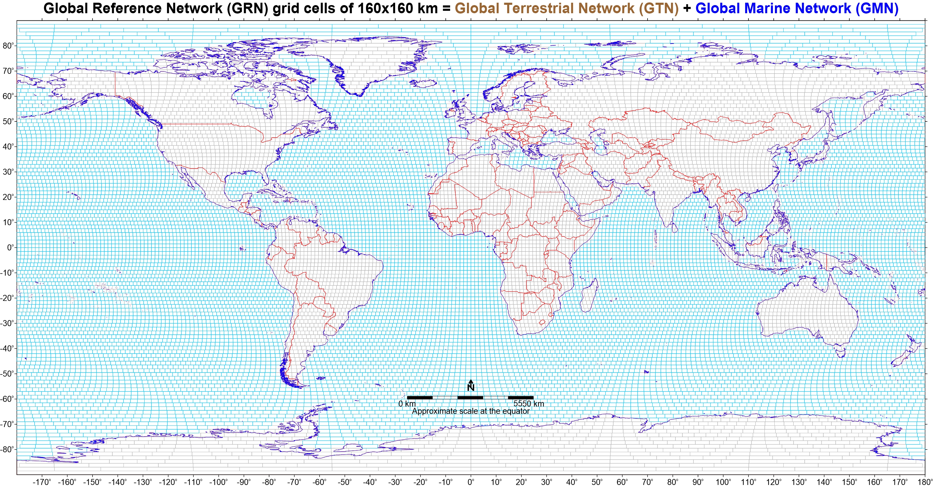
It is worth reading the history of development of the Global Reference Network of 19,833 grid cells of 160x160 km way back in 1994 by Nils Gustavsson (Geological Survey of Finland), which consists of 19,833 grid cells of 160x160 km that cover the whole globe.
The Global Marine Network (GMN) file with 12,477 grid cells of 160x160 km was compiled by subtracting the 7356 grid cells of the Global Terrestrial Network (GTN) from the 19,833 grid cells of the Global Reference Network (GRN).
Planning the sampling campaign of the marine environment, the recommendation is to extend the random sampling design of the terrestrial domain in the marine realm. The continental-scale FOREGS Geochemical Atlas of Europe has proven that the 5-random sampling site scheme in each 160x160 km grid cell is cost-effective, and produces interpretable results, i.e., providing the geochemical baseline against which future changes may be recognised and quantified. Of course, only large continental-scale geochemical patterns are visible at this wide-spaced sampling scheme. As the “Blue Book” recommends also 8-random sampling sites in each 160x160 km grid cell, these are given too but not recommended, especially for the marine environment mainly because of costs and practical difficulties.
Xiaoyuan Geng and Juanxia He (Canadian Soil Information Service, Science and Technology Branch, Agriculture and Agri-Food Canada, http://sis.agr.gc.ca/) in October 2020 have generated the 5 and 8 random points within each GMN grid cell of 160x160 km.
The map below shows the Global Reference Network (GRN) with the 19,833 grid cells of 160x160 km, which includes the Global Terrestrial Network (GTN) of 7356 grid cells, and the Global Marine Network (GMN) of 12,477 grid cells:
GMN random sampling design
The sampling points in each Global Marine Network (GMN) grid cell of 160x160 km are totally randomised and are not designed to show the lowest natural background concentrations in the global marine environment, but to demonstrate the current geochemistry of the surface and sub-surface sediments, and possibly the sea water column.
Some GMN cells are located in more than one country’s marine jurisdiction. In these cases, the sampling of that particular GMN grid cell is coordinated by the country (organisation) in which the centre of the grid cell is located.
In the Microsoft Excel files, country names are not given for each random point because not all countries have defined their continental shelves and Exclusive Economic Zones. As there are still disputes between neighbouring countries, it was considered prudent not to assign country names to sample sites and GMN grid cells.
The Marine Regions Organisation has a database for the Global Exclusive Economic Zones according to the 1982 United Nations Convention on the Law of the Sea over which a sovereign state has special rights regarding the exploration and use of marine resources, including energy production from water and wind.
For further information consult the Marine Regions Organisation website: https://www.marineregions.org/
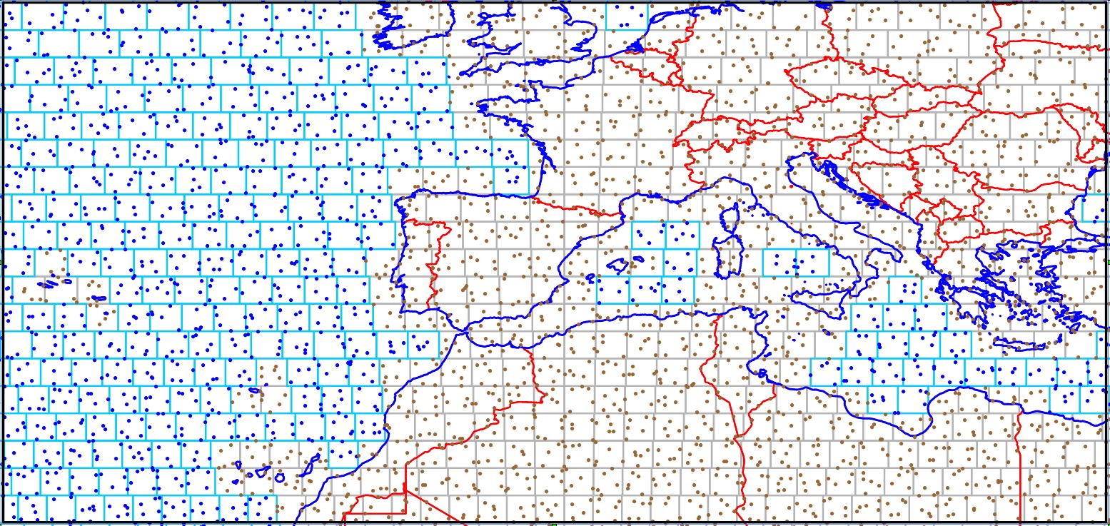
The map below shows the 5 random sites (blue dots) within the 160x160 km grid cells in the marine realm (the philosophy of the random sites is explained on the web page of the GTN sampling design, which should be consulted):
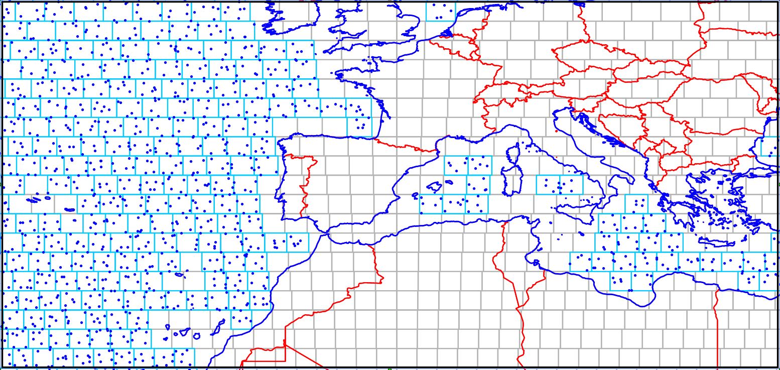
On the map above there are no random points in grid cells near the coastal zone of countries, and around islands. The reason is that these random sites are included in the GTN Microsoft Excel files, which should be downloaded from the relevant web page.
The map below shows the 5 random sites within the 160x160 km grid cells of both the marine (blue dots) and terrestrial (brown dots) parts: